Global warming has made farming a stressful task. Rising temperatures are decreasing soil health and water retention, causing crops to lack peak freshness at harvest.
These conditions are disastrous in industries like wine production, and some of the most famous wine blends are suffering. The agriculture industry is turning to technological solutions, particularly those based on data analytics, to mitigate the risk of more climate-related problems.
Satellite data can provide farming operations with ample information about the health of crops. It allows growers to gather vegetation before more damage occurs. Several private-sector ventures are granting farmers access to these data analytics.
Ticinum Aerospace has been innovating satellite agriculture tech for quite some time. Most notably, its Saturnalia services have become increasingly popular in viticulture.
At the 2023 Wine2Wine international forum in Verona, Italy, Ticinum showcased how helpful the Saturnalia software can be for vintners. It started in 2014 and is one of the leading wine-business events in the world, where ideas and technology are shared amongst wine producers.
The belief is more publicly accessible data for winemakers will ensure grape health and top-quality wines. It also gives them more insight before making expensive decisions regarding crops.
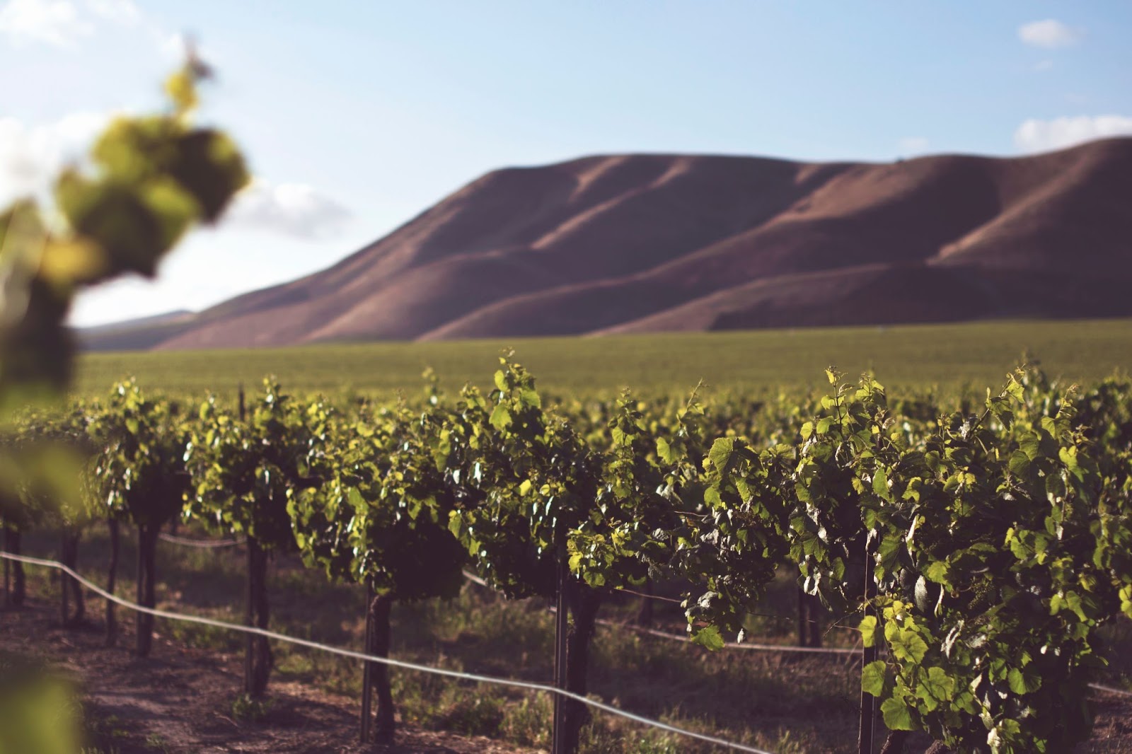
Photo Courtesy Tim Mossholder
The company released a case study of how Saturnalia collected and analyzed data for the 2022 Barolo grape harvest. With Italy suffering a severe drought, Saturnalia was able to give winemakers insights to gather grapes at a different time or switch to irrigation for the lack of rain.
“Sometimes producers don’t collect data on grapes, or they do, but it’s not stored in an easy way, or they don’t know which plots they collected samples from,” Daniele De Vecchi, project manager at Ticinum for Saturnalia, explained to Bloomberg.
Another satellite data firm, TerraNIS, is making waves in French wine. Using satellite and drone images, it gives farmers digital observations about the state of growing land and how best to manage it. The Oenoview software can be used to prepare for harvests, provide insights on fertilization, follow plant growth, and evaluate water stress.
The company also has land and environmental management data analysis software called Pixagri.
Satellite images can help farmers implement better irrigation, monitor soil health, and ensure crops are receiving the most nutrients.
Satellite data collection is being applied to general agriculture, too. Cutting-edge satellite sensor technology could play a significant role in slowing down world hunger. Experts envision a future where farmers can manage fields based on mostly free Earth-observation data about crop disease, pest infestation, nutrient needs, water stress, ideal harvest time, and quality evaluation.
According to a World Economic Forum report, it could save greenhouse gas (GHG) emissions by 13%. The report says the market for satellite data in agriculture will double close to or greater than $1 billion by 2030. Farmers will also see market growth of $500 million thanks to satellite data insights. Satellite-based ag data could become a mainstream tool across small, medium, and mega-farms.
The report also offers a comparison of free data versus paid data. The private sector is innovating these solutions. Airbus, BlackSky, and Satellogic have arrays orbiting Earth and are willing to work with farmers.
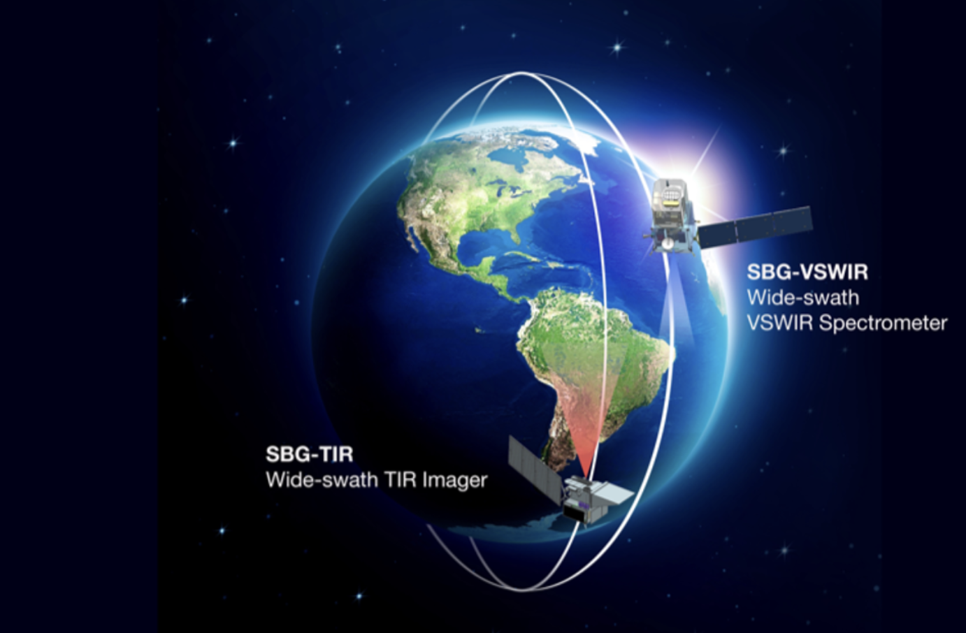
Photo Courtesy NASA
NASA is still involved in the satellite agriculture craze. The space agency’s Surface Biology and Geology (SBG) project uses artificial intelligence to study infrared waves — both shortwave and thermal — to “investigate ground/water temperature, snow reflectivity, active geologic processes, vegetation traits, and algal biomass.”
NASA’s Artificial Intelligence Group has been working on the project since 2017. Progress was made this year with two SBG satellites in development.
They will use Compressed Large-scale Activity Scheduling and Planning (CLASP) software to simulate mission trajectories while creating a baseline for future models. Theories can be crafted from the CLASP technology, leading to more climate-conscious decisions.
The U.S. Government and the European Union are tapping into satellite data. They will use it to monitor GHG emissions, fertilizer use, ocean health, and improve communication channels.
Solutions can’t be implemented until officials see the issues on the ground; a delicate balance will be needed. Satellite data can be a vital tool for agricultural improvement, but it is not the cure-all. The assessments of crops and land from space will be paramount to keep food supplies plentiful and our wine flowing.